Sydney travel blog day 3
Tuesday 17 January 2023
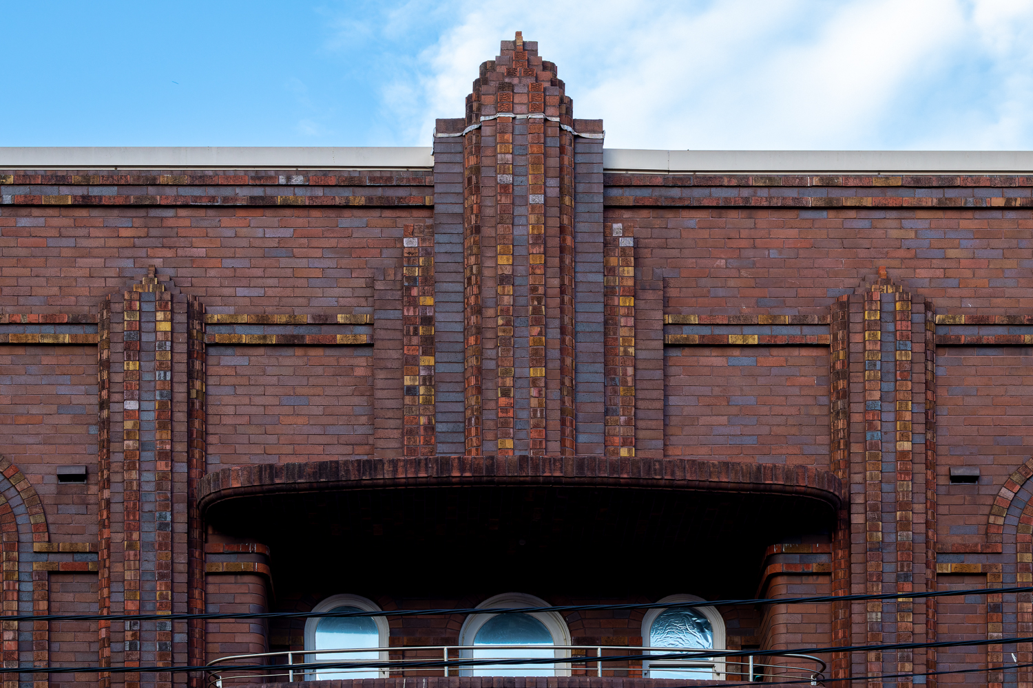
Randwick Art Deco
According to the handy Randwick Art Deco Walk brochure from Randwick City Council, in the 1920s-1940s, when Art Deco was particularly popular, there was an “explosion of residential building activity in Randwick and Coogee, catering for the boom in population between the wars”.
Having had this walking guide sitting on my computer for several years, I was excited to be staying in Randwick and to have a chance to see the buildings described in the brochure.
If the weather were favourable, I imagine you could do the entire walk in two or three hours, allowing time to stop and photograph the buildings. I decided to take it easy and do it over two or three mornings because I still had to take Kramstable to NIDA and I didn’t want to be wandering around in the heat.
The first day, I started at The Spot, which was near our accommodation, and was the start of the walk on the map.
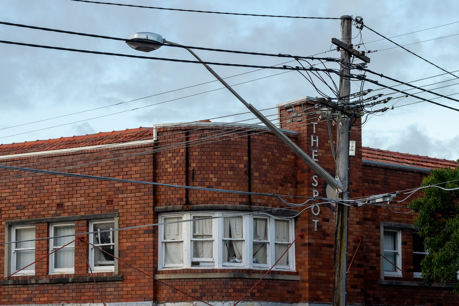
The Spot is a small shopping centre on Perouse Road (which is the street running behind the street we were staying on), and St Paul Street. The Ritz Cinema is there, along with a good range of restaurants and cafes, most with outdoor dining.
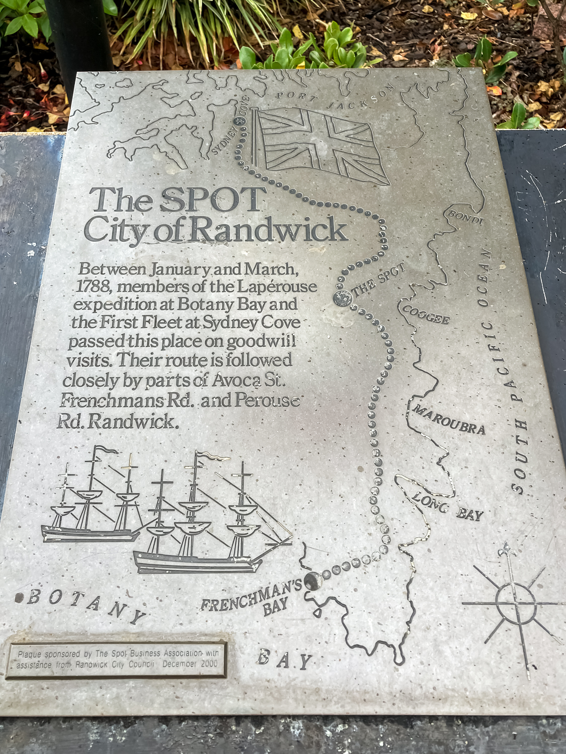
According to a plaque on the corner, in 1788, members of the Lapérouse expedition at Botany Bay and the First Fleet at Sydney Cove passed this place on goodwill visits. What that actually involved, it doesn’t say.
There are 20 buildings on the walk, most of which have a short description and photo in the brochure. When I’ve edited them, I’m going to put all of them over on my photoblog rather than try to get through all 20 here.
Today, I got to about 14 of the buildings and did the longest part of the walk before I went back to take Kramstable to NIDA.
Light rail
I didn’t know much about Sydney’s light rail system. I vaguely remember seeing it years ago (back in the monorail days), when I think there was only one line and it went around some of the city, to (what was then called) Star City Casino and the fish market.
Now, it has three lines, two of which start at Circular Quay and follow the same line through the city to Moore Park (where the sports grounds and entertainment precincts are). From there, line three continues along Anzac Parade to Kingsford, and line two veers off around the Randwick race track and ends up in High Street Randwick. This was about five minutes walk from where we were staying.
Line three has a stop right outside NIDA and today I decided to take what was supposed to be my only trip into the city after I dropped Kramstable off.
I had one mission: to see Town Hall House.
Note for the unwary: when paying for your travel, you tap on and off on the platform. Not on the tram.
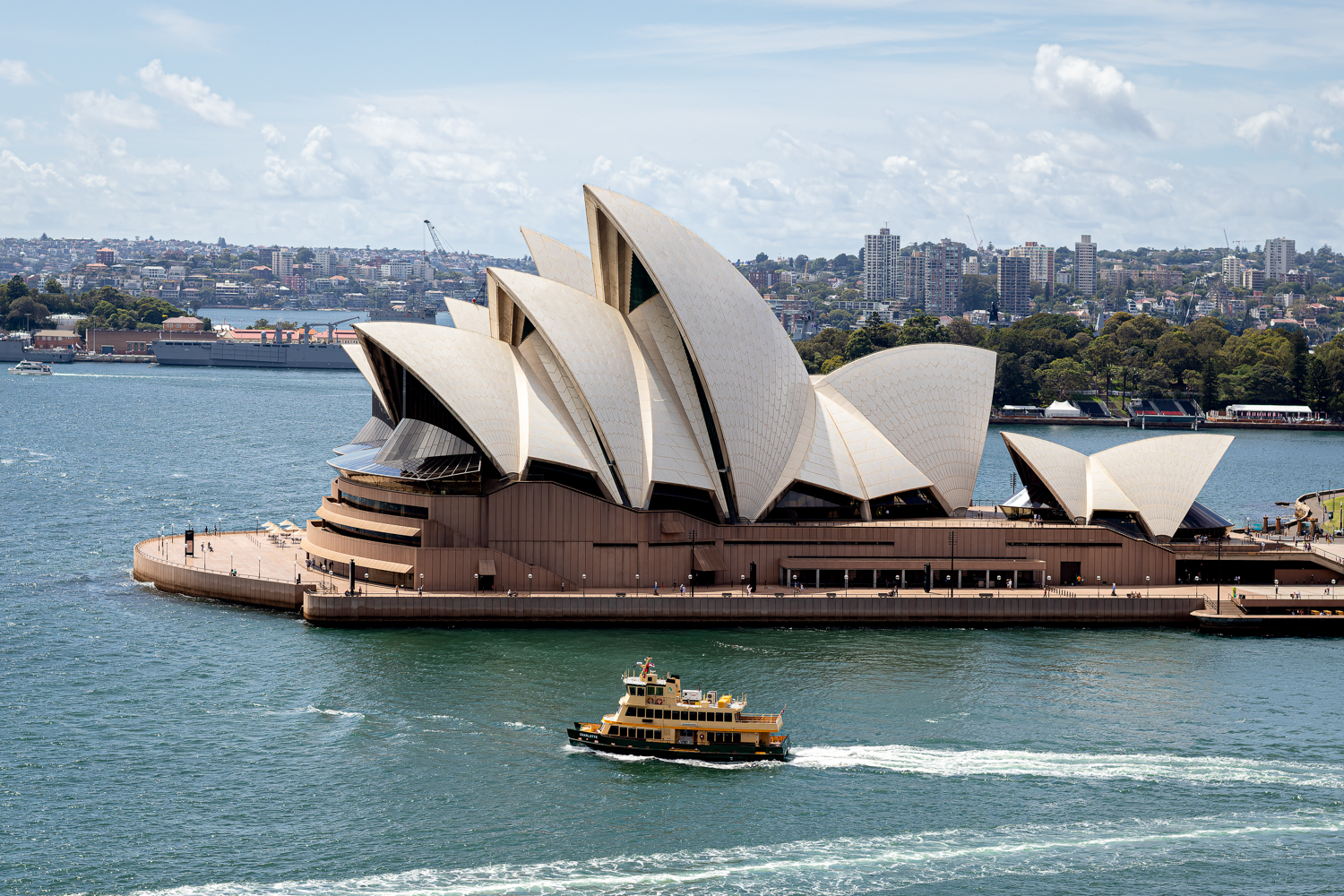
Sirius and the Sydney Harbour Bridge
Once I was on the tram, I changed my mind and travelled all the way to Circular Quay. I had my trusty Sydney Modern 1950—1990 Footpath Guide with me. It mentioned the Sirius apartment building and the AMP building, both of which I wanted to see, and both of which were around the Circular Quay area.
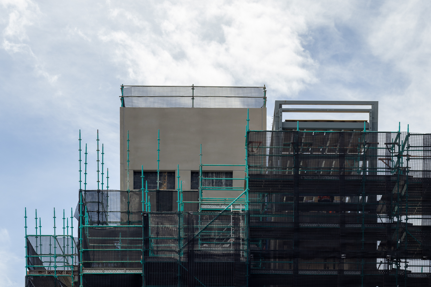
Circular Quay was packed. There was a mega plague ship there, kazillions of people and barely a mask in sight. I didn’t want to stay there so I made my way to The Rocks to try and find Sirius (Tao Gofers, 1980).
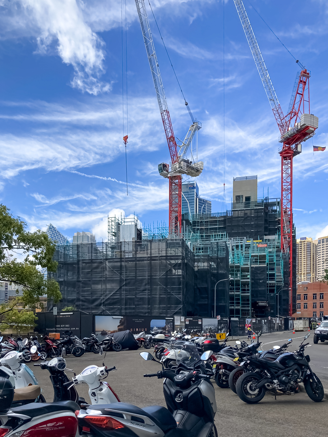
I knew there was a plan to redevelop Sirius from its social housing origin to some fancy expensive boutique apartments, but hadn’t realised it was well underway. I felt sad that I never got to see it.
By this time I was under the Sydney Harbour Bridge, and I found a random lift on the street that went up to the bridge itself. Not the walk the bridge thing but walking across the bridge. I didn’t know you could do that, so I did.
I found the original plaque, which mentions the designers, the builders and the politicians involved in constructing it, including the firm Dorman Long and Company, who were the contractors for design and construction. My great grandfather worked for that company in the 1920s and my mother says he was involved in the bridge design. I have no reason to disbelieve this. He was a structural engineer who specialised in bridges and he worked for the contractors.
That’s cool.
I decided not to take the lift to the top of the pylon. The view was pretty good from where I was.
I wanted to go see the next building on my list, the AMP building back at Circular Quay (Peddle Thorpe and Walker, 1962). I could see a building covered with scaffolding from the bridge and I hoped it wasn’t that one . . .
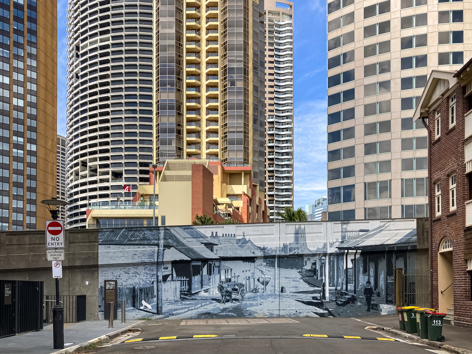
I walked along the Cahill Walk, which accompanies the Cahill Expressway off the bridge, wondering if I was about to find myself in a Jeffrey Smart painting. (I wasn’t. It’s on the other side.) I could see the last remaining part of Sirius that wasn’t totally covered and this last remnant reminded me of the story of the last resident of the complex, Myra Demetriou.
There’s some plaques along the walk that tell how the expressway was built and what had to be demolished to make way for it. Entire streets, and there was a full wall mural on the side of the road that showed what the street I was standing in would have looked like in 1901.
Remember the scaffolded building I saw? It was the AMP, currently being “re-imagined for a new future of work”.
At least the Tom Bass sculpture on the wall was still visible.

Town Hall House
After two disappointments, I decided I needed to go and see what I really came for. I’d seen a glimpse of Town Hall House (Ancher Mortlock and Woolley) from the tram so I knew it wasn’t being redeveloped. At least not on the outside.
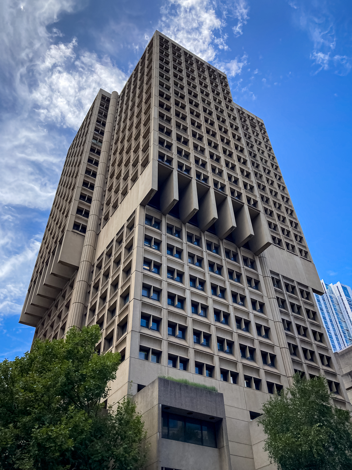
It’s a beautiful building, constructed in 1977, and I was so happy to see it and be able to photograph it. It wasn’t the easiest place to photograph in the crowds and the heat but it was wonderful to finally be there.
I spent about an hour with it looking at every angle I could find.
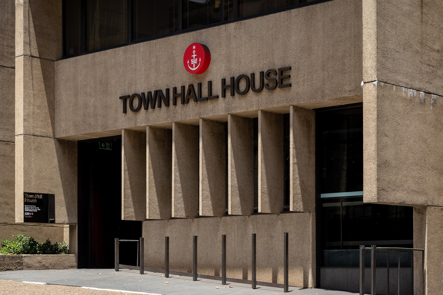
For someone still recovering from a back injury, spending a lot of time bending backwards to gaze at a 25-storey building was probably not a good idea. An hour of this was too much.
I would have loved to have looked for some of the other buildings in the book, but it was too hot and I was in too much pain, so after 86 photos, I put the camera away, headed back to the tram stop and went back to the hotel. The other buildings would have been a bonus. I’d seen what I’d wanted to see for so many years and it was time to call it a day.